- ▾ Other ShakeOuts ▾
- Alaska
- American Samoa
- Arizona
- British Columbia
- California
- Central U.S. (AL AR IA IL IN KS KY LA MO MS NE OH OK TN)
- CNMI
- Colorado
- Guam
- Hawaii
- Idaho
- Japan
- Montana
- Nevada
- New Mexico
- New Zealand
- NorthEast U.S. (CT MA ME NH NJ NY PA RI VT)
- Oregon
- Puerto Rico
- Quebec & Eastern Ontario
- SouthEast U.S. (DC DE FL GA MD NC SC VA WV)
- Texas
- Upper MidWest U.S. (MI MN ND SD WI)
- U.S. Virgin Islands
- Utah
- Washington State
- Wyoming
- Yukon
- Other Countries

Why Should You Participate?
While some areas of California are more likely to have earthquakes than others (see below), all of California is at higher risk compared to the rest of the country. You could be anywhere when an earthquake strikes: at home, at work, at school, or even on vacation.
What we do now will determine our quality of life after our next big earthquake. Are you prepared to survive and recover quickly?
The Great California ShakeOut is an annual opportunity to practice how to be safer during big earthquakes: "Drop, Cover and Hold On." The ShakeOut has also been organized to encourage you, your community, your school, or your organization to review and update emergency preparedness plans and supplies, and to secure your space in order to prevent damage and injuries. ShakeOut is also a reminder for Californians to be prepared financially, such as by exploring earthquake insurance. The not-for-profit California Earthquake Authority offers earthquake insurance throughout California for homeowners, renters, mobilehome owners and condo-unit owners.
Learn more below, or read answers to frequently asked questions.
BENEFITS
Register today so that you or your organization will:
- Be counted in the largest-ever earthquake drill in California!
- Be listed with other participants in your area (Optional)
- Be an example that motivates others to participate & prepare
- Be updated with ShakeOut news and preparedness tips
- Have peace of mind that you, your family, your co-workers and millions of others will be better prepared to survive and recover quickly from our next big earthquake!
EARTHQUAKE HAZARDS
Hazard Information for your ShakeOut Area:
Statewide Hazard Information
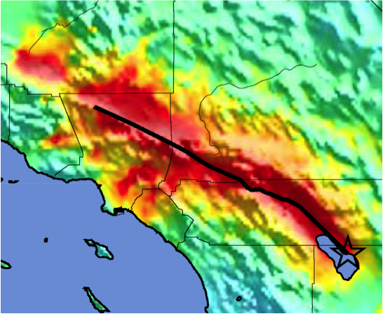
Designed for the original ShakeOut in 2008, the ShakeOut Scenario is a detailed picture of a magnitude 7.8 earthquake along the southern San Andreas fault. The Scenario is also the basis of 2009 ShakeOut activities in Southern California, and is a product of the United States Geological Survey, Multi-Hazard Demonstration Project, led by Dr. Lucy Jones.
MyHazards
California Governor’s Office of Emergency Services
Use this website to discover the hazards that exist in your area and learn how to reduce YOUR risk!
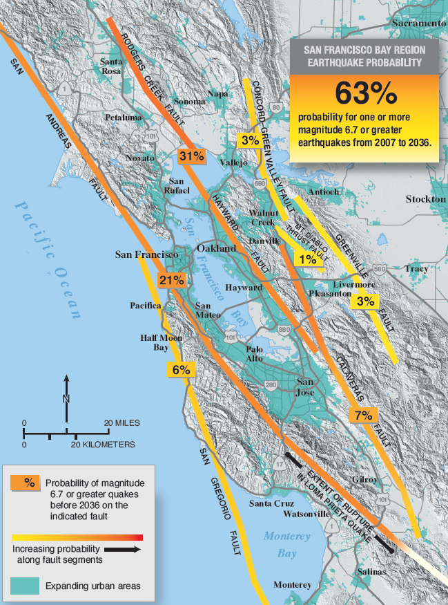
Greater San Francisco Bay Area Fault and earthquake maps, shaking hazard maps, liqufaction maps, and other information
United States Geological Survey, Northern California
North Coast Earthquake and Tsunami information
Redwood Coast Tsunami Workgroup
Fault activity maps, earthquake hazard zone maps, and more
California Geological Survey (CGS)
Forecast of California Earthquakes
Southern California Earthquake Center, USGS, and CGS
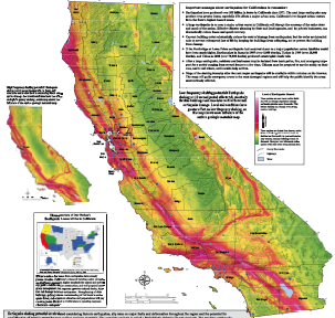
Earthquake Shaking Potential Map of California (2016)
California Geological Survey (CGS)
Maps of recent earthquakes, ShakeMaps for larger earthquakes, email notification, and more
California Integrated Seismic Network
Earthquake, Tsunami, and Volcano Programs
California Governor’s Office of Emergency Services
WHY DROP, Cover, and Hold On?
Learn about Drop, Cover, Hold On from MySafeLA.org
Why is it important to do a Drop, Cover, and Hold On drill? To react quickly you must practice often. You may only have seconds to protect yourself in an earthquake, before strong shaking knocks you down--or drops something on you. Practicing helps you be ready to respond.
- If you are inside a building, move no more than a few steps, then Drop, Cover and Hold On:
- DROP to the ground (before the earthquake drops you!),
- Take COVER by getting under a sturdy desk or table, and
- HOLD ON to it until the shaking stops.
- If you are outdoors when the shaking starts, you should find a clear spot away from buildings, trees, streetlights, and power lines, then Drop, Cover and Hold On. Stay there until the shaking stops.
- If you are driving, pull over to a clear location, stop and stay there with your seatbelt fastened until the shaking stops. Once the shaking stops, proceed with caution and avoid bridges or ramps that might have been damaged.
Ground shaking during an earthquake is seldom the cause of injury. Most earthquake-related injuries and deaths are caused by collapsing walls and roofs, flying glass and falling objects. It is extremely important for a person to move as little as possible to reach the place of safety he or she has identified because most injuries occur when people try to move more than a short distance during the shaking.
Look around you now, before an earthquake. Identify safe places such as under a sturdy piece of furniture or against an interior wall in your home, office or school so that when the shaking starts you can respond quickly. An immediate response to move to the safe place can save lives. And that safe place should be within a few steps to avoid injury from flying debris.
Further information:
