- ▾ Other ShakeOuts ▾
- Alaska
- American Samoa
- Arizona
- British Columbia
- California
- Central U.S. (AL AR IA IL IN KS KY LA MO MS NE OH OK TN)
- CNMI
- Colorado
- Guam
- Hawaii
- Idaho
- Japan
- Montana
- Nevada
- New Mexico
- New Zealand
- NorthEast U.S. (CT MA ME NH NJ NY PA RI VT)
- Oregon
- Puerto Rico
- Quebec & Eastern Ontario
- SouthEast U.S. (DC DE FL GA MD NC SC VA WV)
- Texas
- Upper MidWest U.S. (MI MN ND SD WI)
- U.S. Virgin Islands
- Utah
- Washington State
- Wyoming
- Yukon
- Other Countries

High Sierra Earthquake Hazards
Participants
More than Californians are currently registered to participate in this year's ShakeOut Drill.
are from the
High Sierra area
Number of participants in each category
View names of
participants:
|
|
Learn More
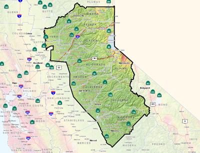
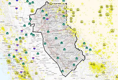
Most people residing in the High Sierra Area are probably not too concerned about seismic hazards. However, moderate to strong earthquakes do occasionally strike in the Sierra Nevada. Such earthquakes usually happen because (1) vertical adjustments are still being made within the recently uplifted (geologic time wise) Sierran block and (2) the range is wedged between two tectonically active areas: On the west side, the North American and Pacific plates continue to crunch and grind past each other, while to east, extensional faulting continues to shape the Basin and Range province. These geologic processes cause stress not only to accumulate within the two individual regions, but also within the Sierra Nevada province. Consequently, at least 20 earthquakes greater than magnitude five (M5), three of which were greater than M6), have been recorded within the area since 1855. Some of these have generated ground shaking and landslides that have caused significant damage to structures and roads.
Of particular interest in the High Sierra Area is the Tahoe Basin. Although, commonly thought to be part of the Sierra Nevada landscape, the Tahoe Basin overlaps the boundary between the Sierra and a narrow tectonic transition zone that separates the Sierra Nevada from Basin and Range province to the east. It is generally accepted that the intensity of extensional tectonism within the Basin and Range progressively increases westward, culminating along the extent of this transition zone. Recent studies reveal that multiple earthquakes of about M7 have occurred within the basin during the last 11,000 years, some within the last few thousand years. Not only is considerable damage and possible loss of life to be expected from such a large magnitude earthquake in present time, the amount of associated surface rupture on one of the faults below Lake Tahoe could generate a 30-foot high seiche wave that could easily destroy lakeside developments. Ground failure in the form of rock falls and other landslides along the steep mountain slopes surrounding the basin, along with liquefaction of sediments deposited within the basin itself, could cause substantial damage in developed areas.
This section will be updated with more detailed hazard information for this area. For now, the following links provide local and statewide earthquake hazard information:
MyHazards
California Governor's Office of Emergency Services
Use this website to discover the hazards that exist in your area and learn how to reduce YOUR risk!
Fault maps, historic earthquakes, how the ground is expected to shake, and much more
California Geological Survey (CGS)
Fault and earthquake maps, shaking hazard maps, liqufaction maps, and other information
United States Geological Survey, Northern California
Forecast of California Earthquakes
Southern California Earthquake Center, USGS, and CGS
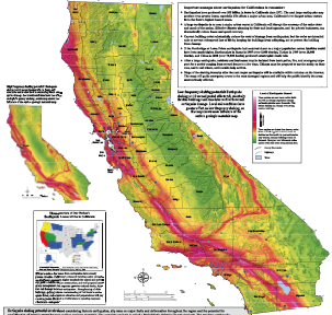
Earthquake Shaking Potential Map of California (Dec. 2008)
California Geological Survey (CGS)
Maps of recent earthquakes, ShakeMaps for larger earthquakes, email notification, and more
California Integrated Seismic Network
Earthquake and Tsunami Hazards and Mitigation Information
California Governor's Office of Emergency Services

