- ▾ ShakeOut Regions ▾
- Alaska
- American Samoa
- Arizona
- British Columbia
- California
- Central U.S. (AL AR IA IL IN KS KY LA MO MS NE OH OK TN)
- CNMI
- Colorado
- Guam
- Hawaii
- Idaho
- Japan
- Montana
- Nevada
- New Mexico
- New Zealand
- NorthEast U.S. (CT MA ME NH NJ NY PA RI VT)
- Oregon
- Puerto Rico
- Quebec & Eastern Ontario
- SouthEast U.S. (DC DE FL GA MD NC SC VA WV)
- Texas
- Upper MidWest U.S. (MI MN ND SD WI)
- U.S. Virgin Islands
- Utah
- Washington State
- Wyoming
- Yukon
- Other Countries

San Diego County Earthquake Hazards
|
|
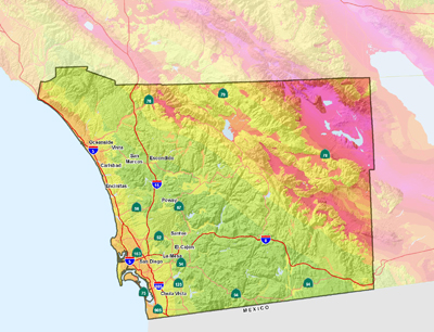
When people think about natural disasters in the San Diego County area most thoughts are likely put towards wildfires and landslides, but residents of the San Diego Area are far more susceptible to earthquake damage than most think.
In southern California the San Andreas Fault often gets most of the attention, and both it and the San Jacinto Fault (the State's second most active fault, which runs through northeast San Diego County) are more than 60 miles away from the more populated parts of the county. This distance, and the lack of recent damaging earthquakes, may lead many residents of the San Diego area to believe that earthquakes are a problem for the rest of southern California. However it may surprise many to know that a major fault, called Rose Canyon, cuts right through the heart of downtown San Diego, through the center of San Diego Bay, and north through La Jolla and northward along the coast. This should be cause for concern among all citizens in the area.
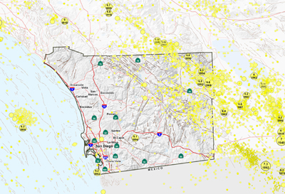
Frequent earthquakes in other southern California counties remind residents that they live in earthquake country. There are hundreds of active faults scattered throughout the region, and even though there are long periods between earthquakes on any particular fault, often much greater than a human lifetime, one or two of the many hundreds of faults has a significant earthquake every decade or so. These earthquakes are often felt in San Diego County but are usually too distant to cause more than a gentle roll. But it is possible for a large earthquake on the Elsinore or San Jacinto faults, and even the San Andreas, to cause much stronger shaking in San Diego county than has recently been experienced, with damage greatest in North and East County areas. Escondido, Poway, Julian and many other communities are very close to these faults.
San Diego County on the other hand does not have the history of earthquakes common to the rest of southern California. The Rose Canyon Fault, the only major active earthquake fault in the urban San Diego Area, has not produced a major earthquake since long before European settlers arrived in the area. Yet it is considered active by the State as it has had a history of earthquakes in the last 11,000 years. Our relatively short history in the region has created a false sense of immunity from earthquakes in the San Diego Area, but a major earthquake along the length of the Rose Canyon Fault could result in devastating consequences. The proximity of the fault to the city center and main economic hubs could put the entire area on hold for months or even years. Most residents are less than 15 miles from the fault and ground shaking from a major event is sure to cause damage throughout the county.
Earthquake damage to buildings and infrastructure and secondary effects such as fires that often are started in earthquakes are a very real danger for all residents of the San Diego Area. If a major earthquake occurs during fire season then the fire damage could easily exceed the damage caused by shaking. Still, with proper planning and preparedness, these potential losses can be greatly reduced.
San Diego County Earthquake Information
MyHazards
California Governors Office of Emergency Services
Use this website to discover the hazards that exist in your area and learn how to reduce YOUR risk!
Faults and Earthquakes in San Diego County
San Diego County Natural History Museum
County of San Diego: Earthquake Facts and Preparedness
County of San Diego Office of Emergency Services
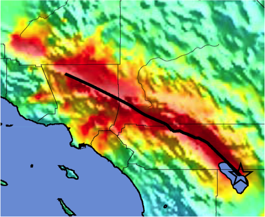
Designed for the original ShakeOut in 2008, the ShakeOut Scenario is a detailed picture of a possible magnitude 7.8 earthquake along the southern San Andreas fault. The Scenario is also the basis of the 2009 ShakeOut activities in Southern California, as much more can still be learned in preparing for such a large earthquake! The Scenario is a product of the United States Geological Survey, Multi-Hazard Demonstration Project, led by Dr. Lucy Jones.
|
|
Fault maps, historic earthquakes, how the ground is expected to shake, and much more
California Geological Survey (CGS)
Forecast of California Earthquakes
Southern California Earthquake Center, USGS, and CGS
Fault and earthquake maps, shaking hazard maps, liqufaction maps, and other information
United States Geological Survey, Northern California
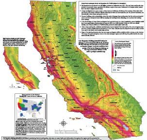
Earthquake Shaking Potential Map of California (Dec. 2008)
California Geological Survey (CGS)
Earthquake and Tsunami Hazards and Mitigation Information
California Governors Office of Emergency Services
Maps of recent earthquakes, ShakeMaps for larger earthquakes, email notification, and more
California Integrated Seismic Network
PARTICIPANTS
people are currently registered to participate in the 2012 ShakeOut Drill.
are from the
San Diego County area
Number of participants in each category
View names of
participants:
Schools
Colleges/Universities
Businesses
Community Groups
Government Agencies
Faith-Based Organizations
Medical Organizations
Other Organizations
